 |
|
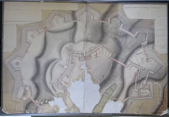
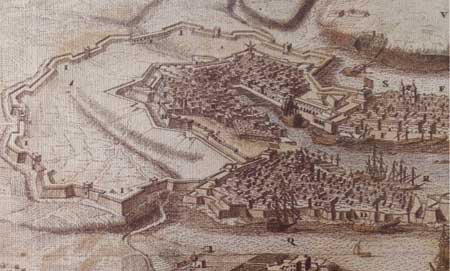
18th Century map of the Cottonera and Sta. Margherita Lines.
|
With the fall of Candia in 1670, the Order – conscious of the half-finished state of the Santa Margerita Lines and their limitations – decided to immediately embark on a new line of fortifications so as to better protect Cottonera and eventually the Grand Harbour area.
The Cottonera Lines were designed by Valperga as a five kilometre line of fortification that comprises of eight bastions that join the extremities of the front lines of Vittoriosa and Senglea from the Post of Castille to Fort St Michael. These were intended to encircle Vittoriosa, Cospicua, Senglea, the San Salvatore Hills, as well as the half-finished Santa Margerita Lines of Cospicua. The scheme was expected to provide shelter for some 40,000 people and their livestock. It was approved on the 2nd April 1670, and the foundation stone was laid on the 28th August 1670 on the site of St Nicholas Bastion.
Count Vernada, while favouring the original eight-bastion layout, preferred that the enceinte be extended in both directions to enclose Corradino Hills, Bighi and the Rinella peninsula. This was an ambitious project since it entailed a high cost and a long time before it was completed. Indeed these plans were never realised.
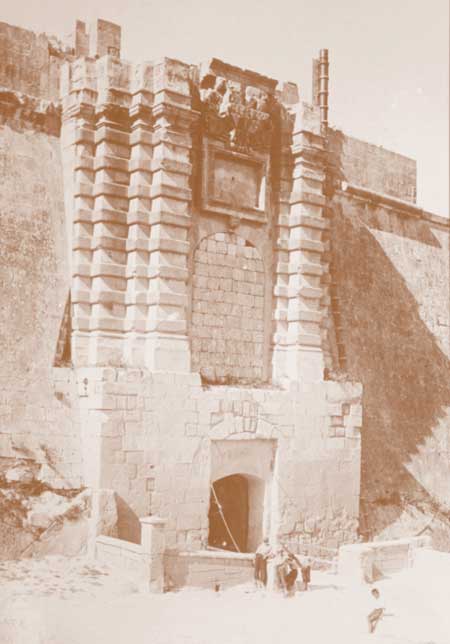
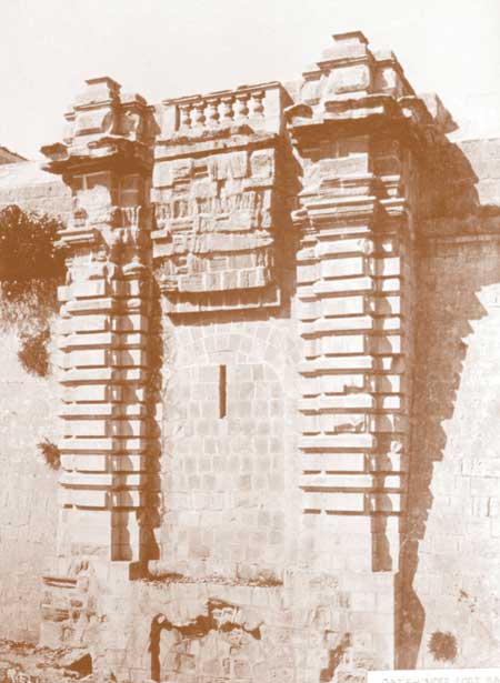
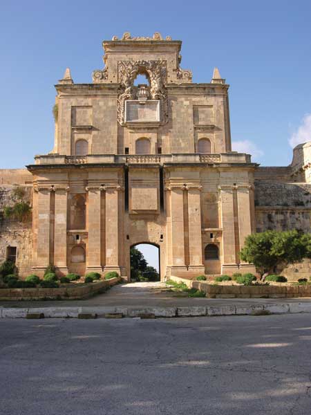
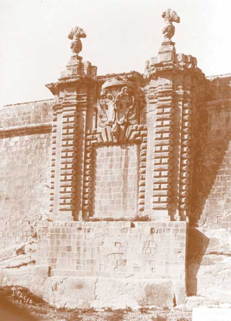
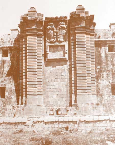
The French engineer Mederico Blondel designed the majestic seven gates that provide access through these walls. These are namely Our Saviour’s Gate, St Louise’s Gate, St James’ Gate, Notre Dame Gate, St Nicholas’ Gate, St John’s Gate and St Paul’s Gate. The latter, together with a part of the fortifications, was dismantled during the expansion of the Naval Dockyard at the beginning of the 20th Century.
 |
|
18th Century map of the Cottonera and Sta. Margherita Lines.
|
By the death of Grandmaster Nicholas Cotoner (1663-80), the main body of the enceinte had been laid down, but Grandmaster Gregorio Carafa (1680-90) had to suspend and virtually abandon the project because of a lack of funds. Also priority had to be given to the Floriana fortifications and as a result the planned ravelins and cavalier, together with the ditch and covert way, were never built.
Under Grandmaster Antonio Manoel de Vilhena (1722-36), the project was again revived with the construction of the St Lawrence demi-bastion, the connecting of St Ursula’s platform with San Salvatore Bastion, and the completion of Fort Salvatore in 1724 – on the very site where once the Turks’ heavy artillery breached the Post of Castille at point blank range.
Nevertheless the works on the Santa Margerita Lines, Fort Ricasoli, and the Cottonera Lines during the 17th Century delineated and eventually consolidated the land phase of the Cottonera Region. At the same time, the building of Valletta on the other side of the Grand Harbour gave the latter a holistic identity with both sides related to and complementing each other.
The Cottonera enceinte was more or less completed between 1723 and 1761 but as with the Santa Margerita Lines it was never fully constructed as planned. Yet the Santa Margerita Lines, and more-so the Cottonera Lines rendered the Vittoriosa and Senglea land-front defences practically obsolete. This is illustrated by the fact that they played no part in the 1798 events. It was however ironic that such an enormous system of bastions and curtains as the Santa Margerita and Cottonera Lines, that were built over the span of a century at such a great sacrifice and cost, could not be properly manned when Napoleon’s troops approached its walls in 1798. The gates were opened without this impressive ‘encyclopaedia of Western fortifications’ ever being put to the test.
 |
 |
|
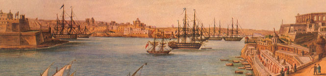
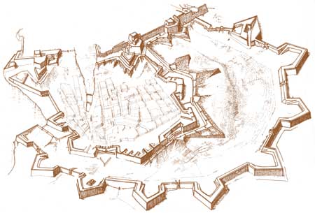
18th Century print showing the Cottonera Lines and the Three Cities and, right, detail of St. Nicholas bastion.
|