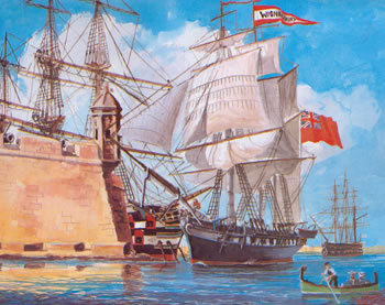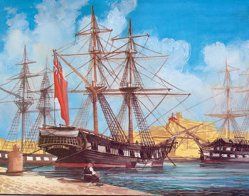
On its arrival to Malta the British Army immediately occupied Fort St Angelo until it was handed over to the Navy in 1912. Up until then, the Navy had an old base ship (the HMS Egmont – previously the HMS Hibernia) moored at the foot of the Fort. On taking over, the Admiralty renamed the Fort HMS Egmont although in 1933 it was once again renamed Fort St Angelo.
The British found the largest concentration of naval infrastructure in the Cottonera area. They inherited a ship building arsenal in Vittoriosa, ship repair facilities in Senglea, and ship fitting sites along French Creek – all in operation since the Order’s era. Furthermore, an 1823 map of the Grand Harbour, drawn by Capt. W.H. Smith RN and preserved in roll No. 89A/11 in the Drawing Office of the Works Department, shows a private dock beneath Corradino Heights on the same site where the Malta Shipyards today has its administration block. The first engineering workshop equipped with machine tools and a foundry was run by Angelo Busuttil and was already in operation in Corradino in 1850.
As with the Order, the Admiralty wished to be self-sufficient in the repair and building of its ships and was quick to realise that all the available facilities were inadequate for the growing requirements of the British Navy. Indeed the need for a new dock had been felt since 1776. The Admiralty thus immediately set its mind to building Dock No. 1 in Vittoriosa. As to its location, the Admiralty first considered the Castle moat, and later the ditch to the west of St John’s Cavalier where work started in 1811 but had to be abandoned by 1813.
In the meantime, the old, arched Arsenal was first converted into a mast-house, which was demolished in 1842, and by 1845 it was replaced by a bakery that was intended to serve the entire fleet. Along the Wharf, sail and rope-making trades flourished, with the latter also extending to the French Curtain – Is-Sur tal-Kurdara, in Vittoriosa. Simultaneously the Navy started by concentrating and encroaching around the Marina Grande which it gradually appropriated for itself, whilst in the process depriving the Maltese inhabitants access to the coast.
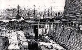
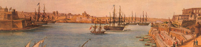
The Admiralty then looked at Cospicua to reach its objective. It encroached up the shore unto the far end of Galley Creek in Cospicua – where it finally replaced the Birgu Arsenal with Dock No. 1 (1843-48) at the substantial cost of Lm 5585. On the anniversary of Queen Victoria’s Coronation, Galley Creek was renamed Dockyard Creek. By 1851 the Admiralty had already consolidated its encroachment along the entire shoreline of Vittoriosa up unto the Dock at the end of the Creek, and kept on creeping along the other side of Dockyard Creek until it reached Macina by 1900. Dockyard Creek was thus confirmed as the main Naval Harbour and commercial traffic was pushed to French Creek. This served to ingrain the naval tradition in the people of Vittoriosa, and the mercantile tradition in the people of Senglea.
Soon after the end of the Crimean War (1854-56), in 1859 the Admiralty proposed and partially financed the building of a commercial harbour in Marsa – getting French, Rinella and Kalkara Creeks in return. It then expropriated French Creek up to Corradino and connected Dockyard and French Creeks on both sides of Senglea by the Short Tunnel in August 1865, and the Church Tunnel in June 1866 – thus sparing Senglea’s Promenade for its inhabitants. The canal that was intended to join Dockyard with French Creek did not materialise.
With the opening of the Suez Canal in 1869 and the increased need for more docking capacity, the Admiralty built Somerset Dock No. 3 (1867-71) in Corradino, and commissioned the hydraulic dock in 1873. It then built Hamilton Dock No. 2 (1883-92), and later Docks No. 4 and 5. This resulted in mercantile activity being pushed further down the harbour towards Marsa.
Having appropriated the whole stretch of coastline all along Dockyard and French Creek (except for the Senglea Promenade), the Admiralty deprived the people of Cottonera – particularly Cospicua’s fishermen and boatmen – from access to the sea with the exception of a few gaps. However the Admiralty provided them with new and more challenging job opportunities connected with the construction of the quay and the dock, and in the running of the dockyards. This boosted Cottonera’s economic and social standards and it was at this time (towards the end of 1900) that Cottonera attracted some of the highest achievers of the Maltese elite.
However, this naval entrenchment into Cottonera and its further systematic encroachment along French Creek not only mirrored its progressive build-up in Malta, but it also completed the consolidation of the Cottonera Region from the seaward side.